| front |1 |2 |3 |4 |5 |6 |7 |8 |9 |10 |11 |12 |13 |14 |15 |16 |17 |18 |19 |20 |21 |22 |23 |24 |25 |review |
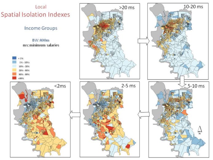 |
And Here are the maps of local Spatial Isolation Index. The richest people are isolated in the central area of the city. It looks like an onion, several layers, each one representing the area where one income group lives, isolated from the others. The richest in the centre and the poorest in the distant suburbs.
|