|
| |
Sedimentation in Western
Pennsylvania
Pittsburgh lies in a geographic region called the "Appalachian Plateau",
which is a topographically
high region west of the Appalachian Mountain chain.
The plateau is made up of erosional remains of a
large sediment-filled basin which was formed and, finally, uplifted as a
result of the plate
tectonic interactions which created the Appalachian Moutains.
Pittsburgh sits on over 16,000 feet (OVER 3 MILES) of sedimentary rock. The
sedimentary rocks generally seen at the surface in road cuts or outcrops in
Pittsburgh were deposited during the Pennsylvanian Period (320 - 290 million
years ago), late in the Paleozoic Era.
These rocks are among the last to have
been deposited in the area. Older sedimentary rocks are buried beneath the
surface, only visible in drill holes or in the few places where rivers cut down
through the stack of rock units, such as in Conemaugh Gorge near Johnstown.
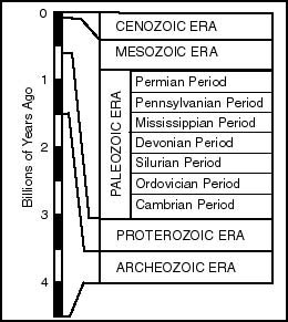
Outcrops in the
Pittsburgh area mostly are part of a rock sequence known as the Conemaugh
Group.
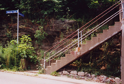
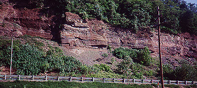
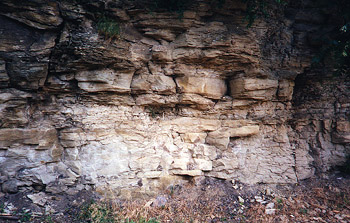
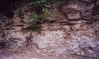
This
picture shows cross
stratification in a sandstone outcropping in Bloomfield. Cross
stratification form from moving sand, pushed either by water or air. The curved
lower surface of these sandstone beds suggests deposition in a river or the
channelized part of a delta . This outcrop is located just across the bridge at
the Pittsburgh Brewery as you turn from Liberty Avenue onto Herron Avenue. This
outcrop is the Morgantown Sandstone, part of the Casselman Formation of the
Conemaugh Group. (site 7 on the map)
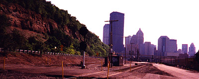
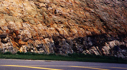
This shows an outcrop in Pittsburgh's
Strip District, directly east of downtown
Pittsburgh off of Liberty Avenue. The
outcrop displays cross stratification in sandy
deposits. Looking at this and
the Bloomfield deposit which is just up the road (across the bridge at the
Pittsburgh Brewery) it is easy to see that this area was part of the
river-dominated part of a delta. This outcrop is the Morgantown Sandstone, part
of the Casselman Formation of the Conemaugh Group.(see site 7 on the map)
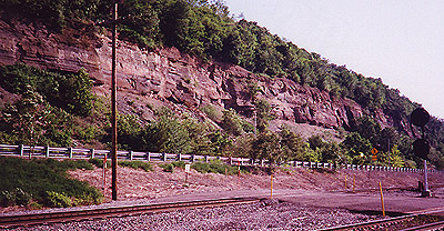
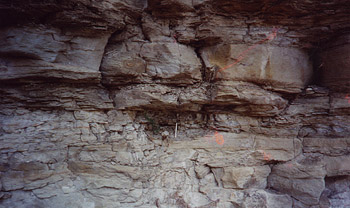
More fluvial deposition in Pittsburgh area. This is the RPS road cut in Moon
Township just off of Montour Run Road. This roadcut shows a lot of cross stratification, filled
channels, and black, organic-rich layers indicating that the rocks are fluvial type deposits.(see
site 1 on the map)
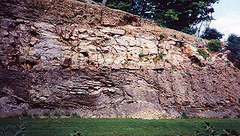
Fluvial type cross stratification in
Oakland. To find this outcrop drive between the Carnegie Museum and the Frick
Art Building. Drive away from Oakland passing over the Panther Hollow Bridge.
Make the first right which is located immediately after the bridge. Stay to the
right. The outcrop is on the left hand side as you drive towards the City of
Pittsburgh's Maintenance and storage area. The outcrop continues along the trail
to the lake. The Morgantown Sandstone is at the top, with the Birmingham Shale
underneath. (Site 3 on the map)
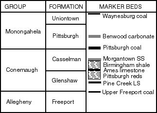
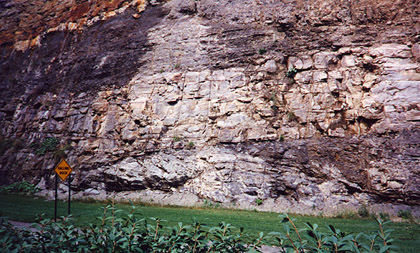
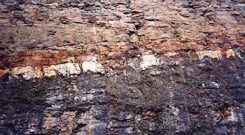
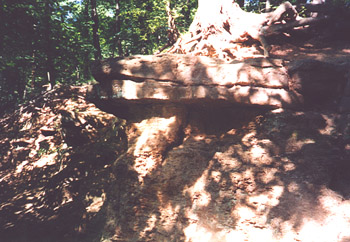
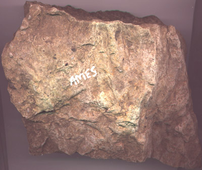
Geologists use marker beds to help identify
which sedimentary layers they are looking at. Marker beds are strata that are
very distictive and stand out. A marker bed may have many specific fossils
and/or be of a specific type of rock. An important marker bed in the Pittsburgh
area is the Ames Limestone. The Ames Limestone has more fossils in it than any
other
layer in the Pittsburgh area. Fossils of Echinoderms, Brachiopods, and Gastropods are found throughout the Ames. The Ames
is the boundary between the Glenshaw and Casselman Formations, both part of the
Conemaugh Group.
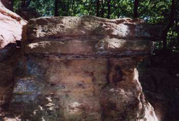
The sedimentary rocks that are exposed in the Pittsburgh area
and lay above the Ames
layer generally show much cross stratification (more of
a fluvial environment).
The sedimentary rock layers that are exposed directly
below the Ames limestone layer
in the Pittsburgh area have been deposited
mostly as bay-filling muds and other low
energy type depositions related to
the seaward part of the delta. (Site 4 on the map)
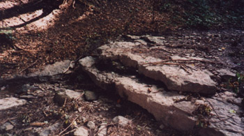
Frick Park is a great place to find the Ames Limestone layer.
Frick Park is
located on the East side of Pittsburgh. Follow Forbes
Avenue through Squirrel
Hill until you see Frick Parks tennis courts on the right.
Turn right at the
tennis courts and Park in the Parking lot beside the tennis courts.
There is a
walking trail which has a entrance from the parking lot. Walk down the
trail
until it comes to a intersection. Make a left at the intersection.
The Ames
layer is exposed a little way down at the bridge on the next left.
A shelter
and water fountain are found in this area. Walk away from the
bridge and past
the water fountain (heading west). The trail goes up a slight grade.
Walk up
the hill a hundred yards or so and the Ames Limestone can be found on
the right
and then the larger outcrop is on the left with many fossils exposed.
The
larger oucrop on the left is a hard ledge in the stream bed, and forms a
waterfall when it rains.
|