|
|
|
|
front
|1
|2
|3
|4
|5
|6
|7
|8
|9
|10
|11
|12
|13
|14
|15
|16
|17
|18
|19
|20
|21
|22
|23
|24
|25
|26
|27
|28
|29
|30
|31
|32
|33
|34
|35
|36
|37
|38
|
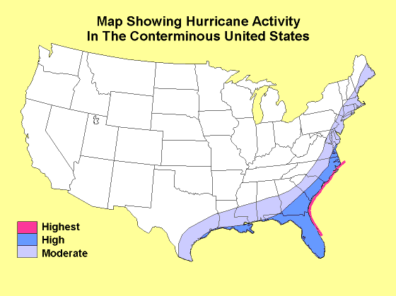 Picture Source: US Geological Survey |
The picture shown here highlights the areas having the greatest amount of hurricane activity in the United States. Florida, Louisiana, and the Atlantic seaboard are at the highest risk. Areas further inland may receive increased amounts of rain associat ed with the hurricane (and sometimes tornadoes) which can pose a flooding threat. |