 |
Over the last century, scientists have learned
a great deal about hurricanes. In the United States, several agencies
actively monitor their development and progress. This information often
leads to predictions regarding the most likely path that the hurricane will
follow, and where it may strike land.
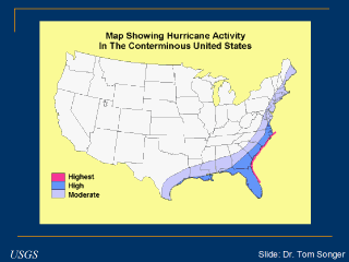
The picture above highlights the areas having the greatest amount of
hurricane activity in the United States. Florida, Louisiana, and the
Atlantic seaboard are at the highest risk. Areas further inland may receive
increased amounts of rain associated with the hurricane (and sometimes
tornadoes) which can pose a flooding threat. |