(for the location of major monuments, see maps included on their individualpages) Unless otherwise noted, all maps in this section are from
Shepherd, William R. Historical Atlas, (New York: Barnes and Noble, 1929)
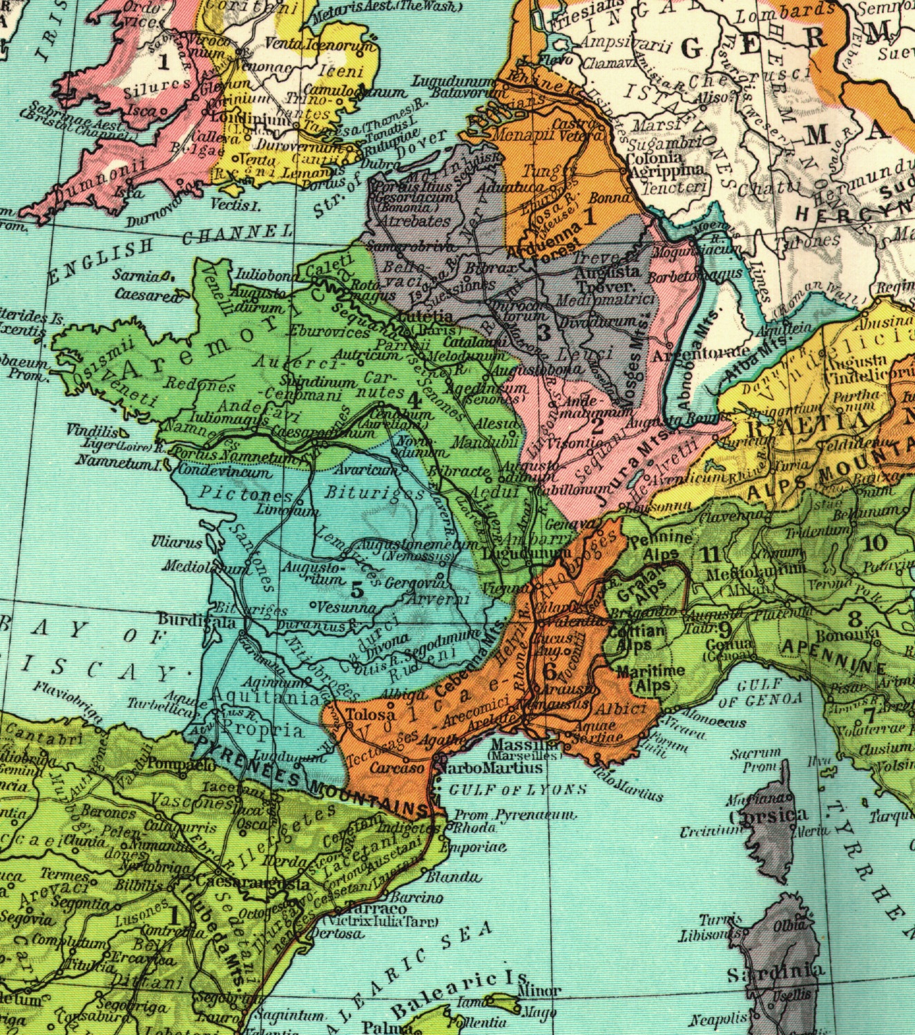
Roman Gaul :Shepherd, p. 38
Eastern Roman Empire about 486 :Shepherd, p. 50
Germanic Kingdoms in 526 :Shepherd, p. 52
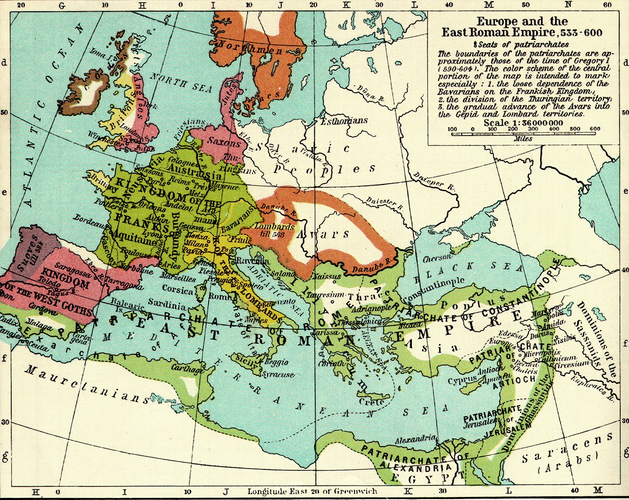
Western Europe 533-600 :Shepherd, p. 52
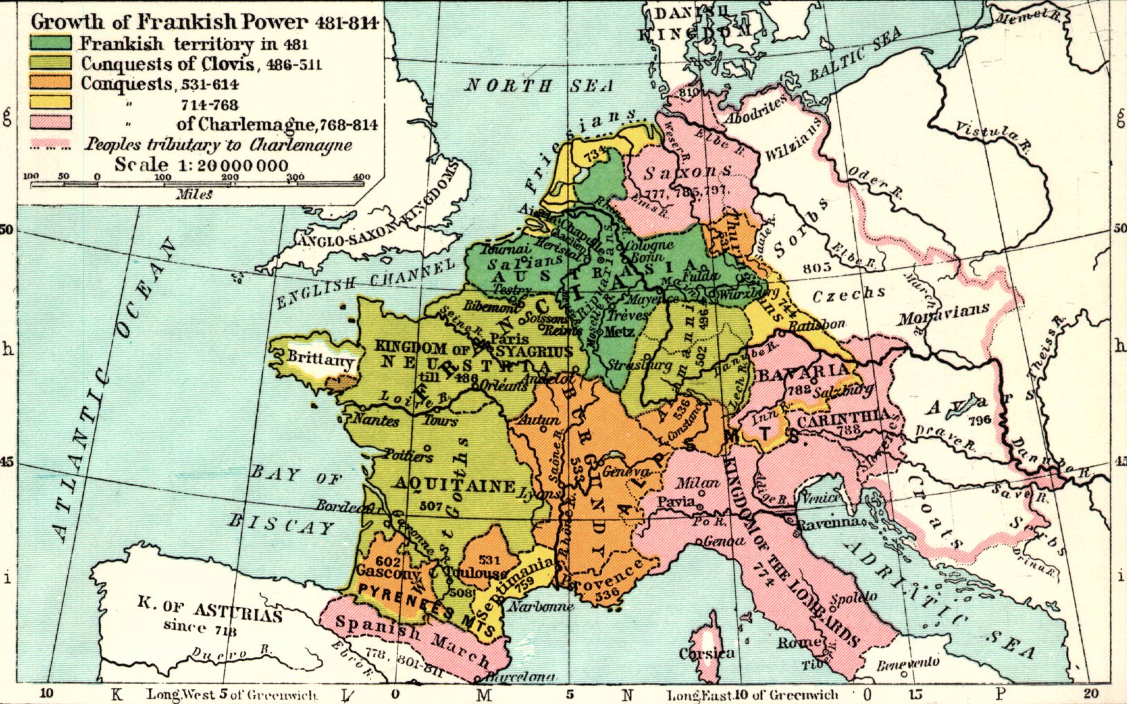
Growth of Frankish Power 481-814 :Shepherd, p. 53
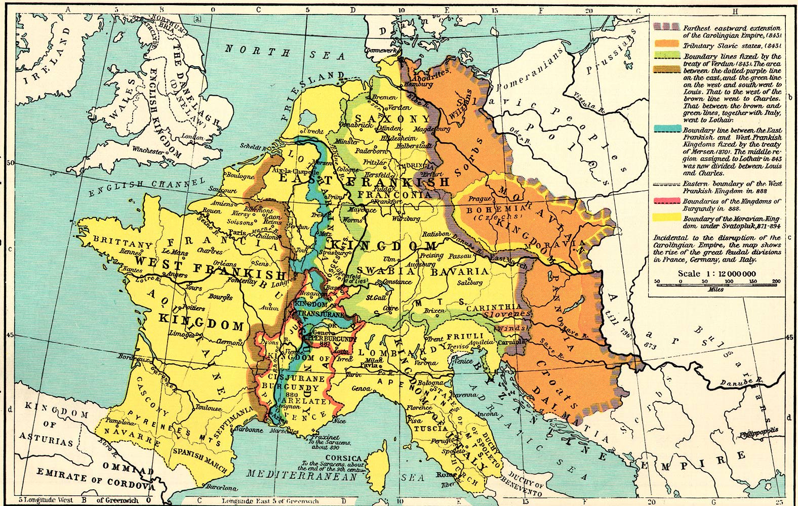
Disruption of Carolingian Empire 843-888 :Shepherd, p. 56
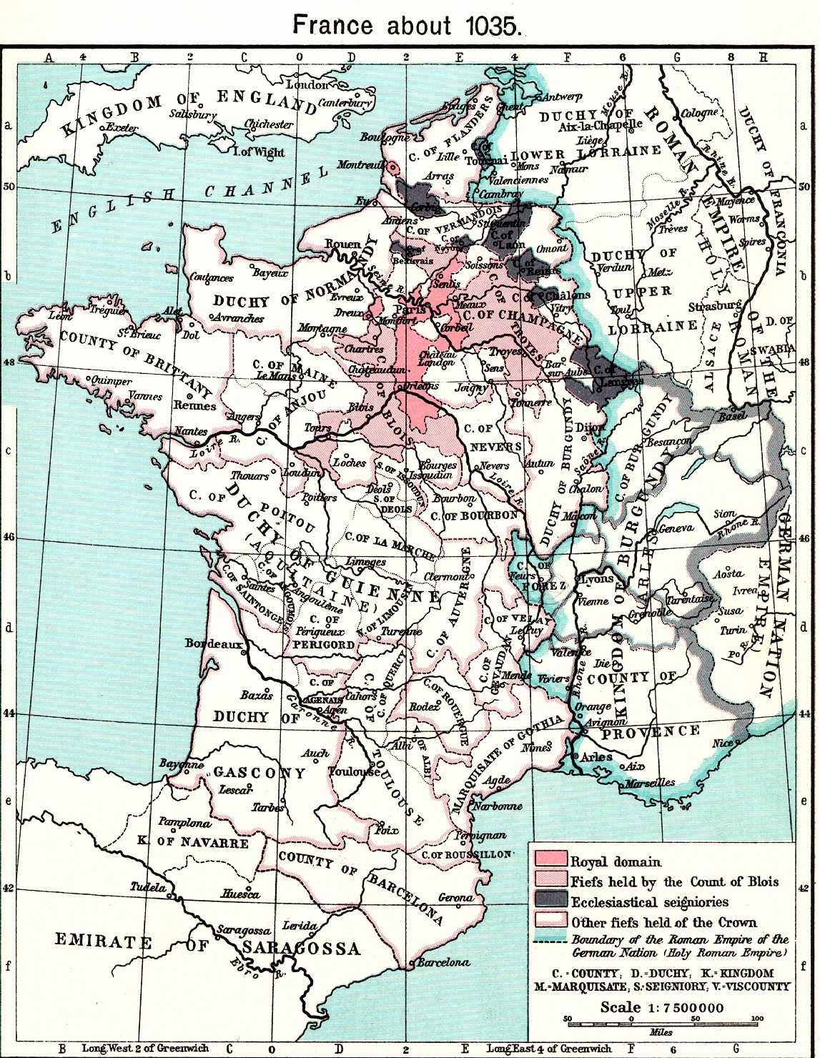
France, about 1035 :Shepherd, p. 651
France in 1154-1184 :Shepherd, p. 69
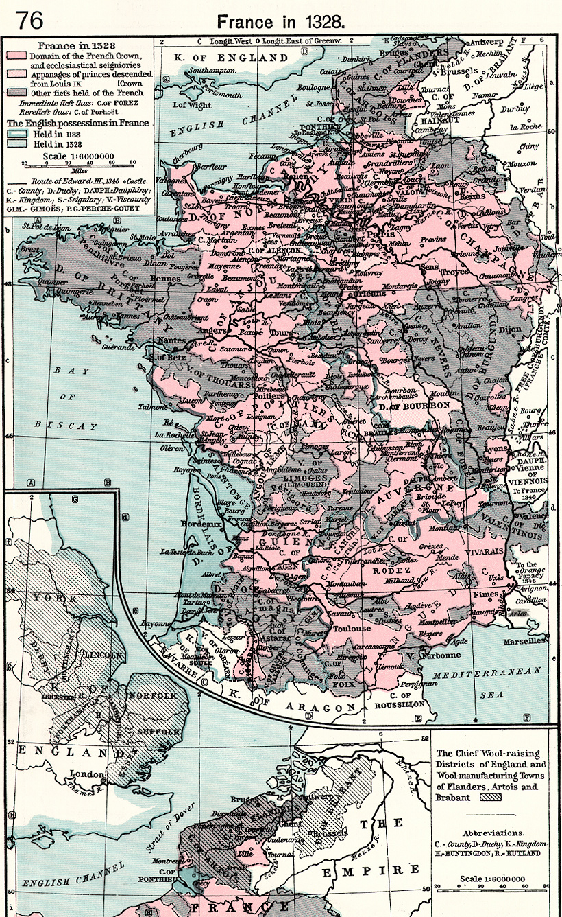
France in 1328 :Shepherd, p. 76
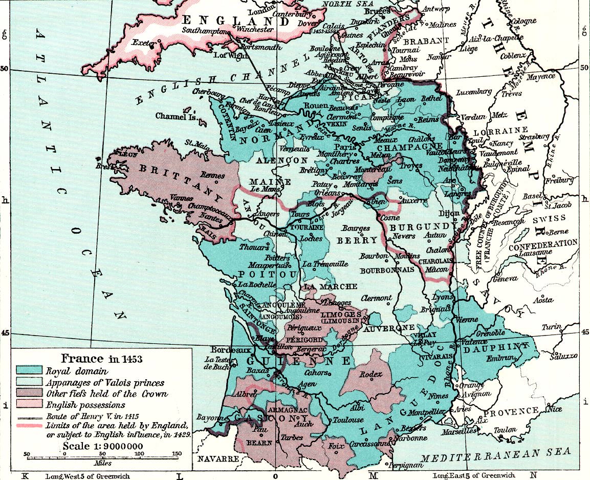
France in 1453 :Shepherd, p. 81
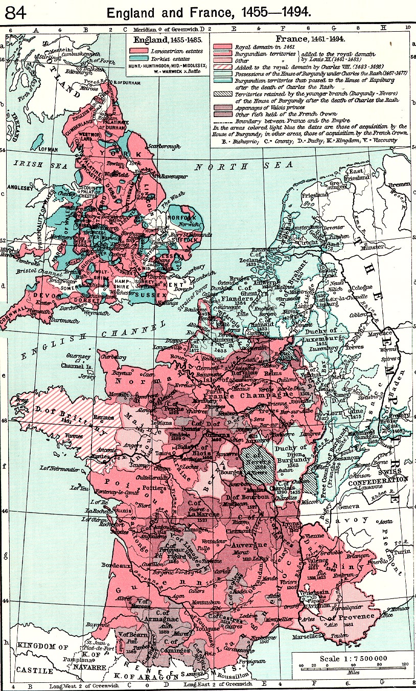
France in 1455-94 :Shepherd, p. 84
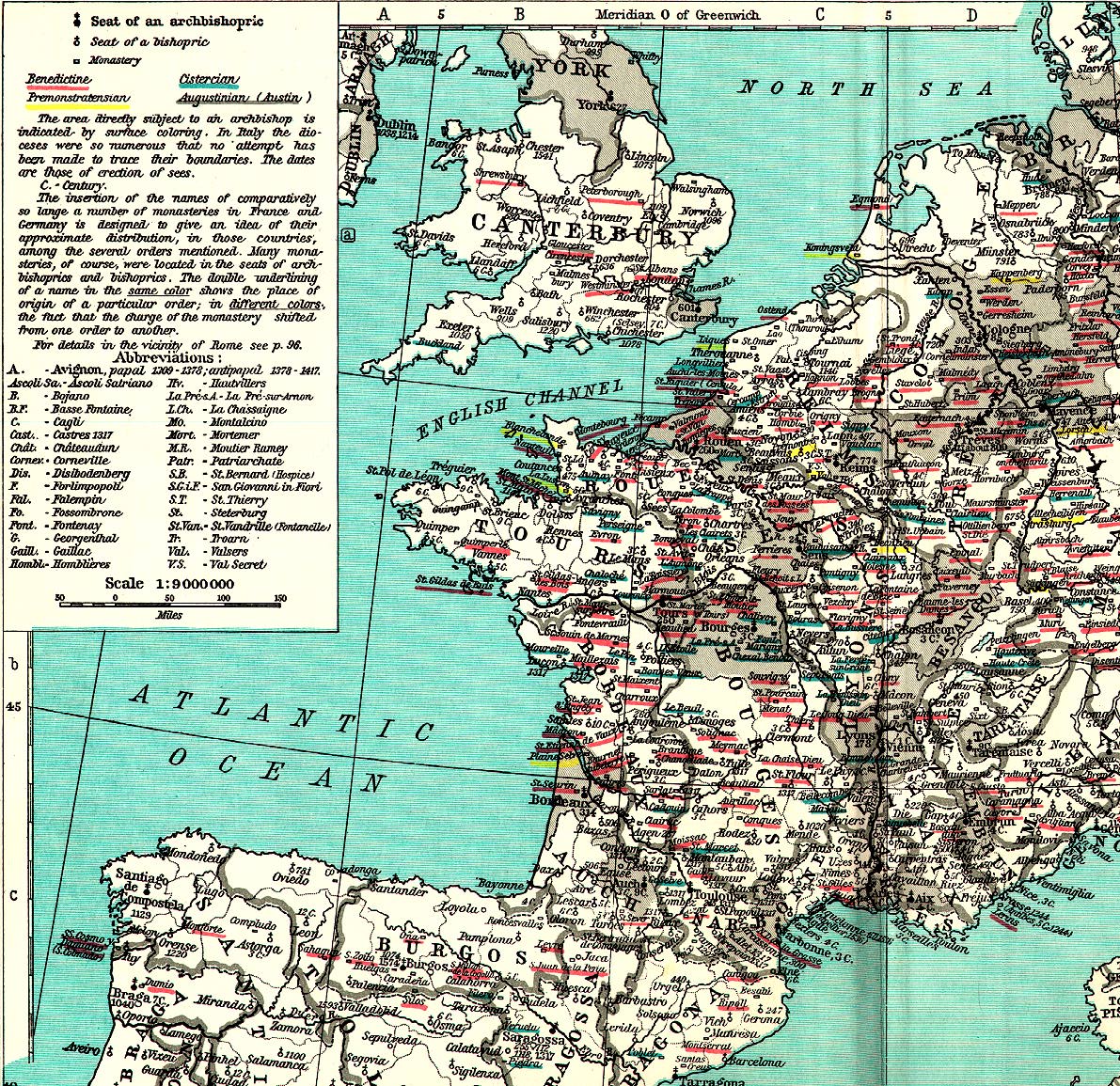
Ecclesiastical Map of France in the Middle Ages :Shepherd, p. 94
Medieval Commerce :Shepherd, pp. 98-99
Medieval Universities :Shepherd p. 100
Medieval Industry :Shepherd, p 102