January 2012.
Click here to view AVI animation of Ohio quake region
Much earlier events
|
|
|
|

|
|
|
|
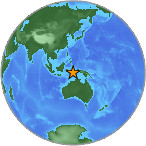
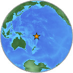
Sept. 19, Magnitude 6.1, south of Java Indonesia, as recorded by UPPA |
|
|
|
|
|
|
|
|

|
|
|
|
Sept 30, Magnitude 6.6, Kuril Islands, as recorded by UPPA |
|
|
|
|
|
|
|
|

|
|
|
|
Updated October 15, Hawaii earthquake, magnitude 6.6 as recorded by UPPA in Pittsburgh. |
|
|
|
|
|
|
|
|
|
Hurricane Wave Noise and an
Earthquake.
|
|
|
|

|
|
|
|
Hurricane wave noise and earthquake surface waves. |
|
|
|
|
|
|
|
Magnitude 7.1 - Mexico and
Scotia Sea earthquakes. Both approximately M=7.1
|
|
|
|
|

|
|
|
|
Note earthquake and usual noise level. |
|
|
|
|
|
|
|
|
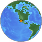
Magnitude 6.4 - ANDREANOF
ISLANDS, ALEUTIAN IS., ALASKA
2006 July 8 20:40:04 UTC
|
|
|
|
")
|
|
|
|
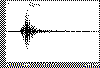
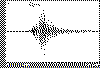
Earthquake record (extracted) |
|
|
|
|
|
|
|
|
|
|
|
Magnitude 6.4 (Strong)
Date-Time
Saturday, July 8, 2006 at 20:40:04 (UTC)
= Coordinated Universal Time
Saturday, July 8, 2006 at 11:40:04 AM
= local time at epicenter
Location 51.259°N, 179.285°W
Depth 50.8 km (31.6 miles)
Region ANDREANOF ISLANDS, ALEUTIAN IS., ALASKA
Distances
195 km (121 miles) WSW (250°) from Adak, AK
365 km (226 miles) WSW (255°) from Atka, AK
2106 km (1309 miles) WSW (252°) from Anchorage, AK
Location Uncertainty horizontal +/- 4.9 km (3.0 miles); depth +/-
5.5 km (3.4 miles)
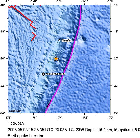
Magnitude 8.0 TONGA
Wednesday, May 03, 2006 at 15:26:35 UTC
|
|
|
|

|
|
|
|
UPPA record of Tonga M 8.0 earthquake |
|
|
|
|
|
|
|
|
|
|
Magnitude |
8.0 (Great) |
|
Date-Time |
Wednesday, May 3,
2006 at 15:26:35 (UTC)
= Coordinated Universal Time
Thursday, May 4,
2006 at 4:26:35 AM
= local time at epicenter
Time of Earthquake in other Time Zones
|
|
Location |
20.035°S, 174.227°W |
|
Depth |
16.1 km (10.0 miles) (poorly
constrained) |
|
Region |
TONGA |
|
Distances |
155
km (95 miles) S of Neiafu, Tonga
160 km (100 miles) NE of NUKU'ALOFA,
Tonga
455 km (280 miles) S of Hihifo, Tonga
2145 km (1340 miles) NNE of Auckland, New
Zealand
|
|
Location Uncertainty |
horizontal +/- 7.9 km (4.9 miles); depth
+/- 32.2 km (20.0 miles) |
|
Parameters |
Nst=161, Nph=161, Dmin=725.7 km, Rmss=0.9
sec, Gp= 29°,
M-type=moment magnitude (Mw), Version=6 |
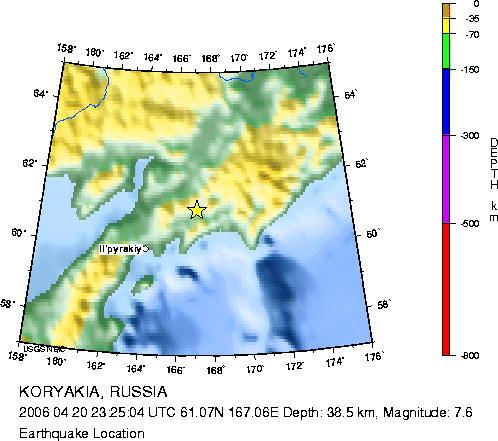
Magnitude 7.6 - KORYAKIA, RUSSIA
2006 April 20 23:25:04 UTC
|
|
|
|

|
|
|
|
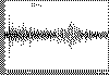
Recording of Koryakia, Russia earthquake. This was a large event, probably located along the northern Bering Sea plate boundary. |
|
|
|
|
|
|
|
|
 followed by surface wave arrivals.")
|
|
|
|
The extracted earthquake. Note the initial body waves (left) followed by surface wave arrivals. |
|
|
|
|
|
|
|
|
Magnitude
Magnitude 7.6 (Major)
Date-TimeThursday, April 20, 2006 at 23:25:04 (UTC) =
Coordinated Universal Time
Friday, April 21, 2006 at 12:25:04 PM = local time at
epicenter
Time of Earthquake in other Time Zones
Location 61.069°N, 167.056°E
Depth 38.5 km (23.9 miles) set by location program
Region KORYAKIA, RUSSIA
Distances 200 km (125 miles)
NE of Il'pyrskiy, Russia
660 km (410 miles) N of Nikol'skoye, Komandorskiye Ostrova, Russia.
670 km (415 miles) WSW of Anadyr', Russia
6330 km (3930 miles) NNE of MOSCOW, Russia
Location Uncertainty horizontal +/- 4.9 km (3.0 miles); depth
fixed by location program
Parameters Nst=201, Nph=201, Dmin=779 km, Rmss=0.89 sec, Gp= 32°,
M-type=moment magnitude (Mw), Version=7
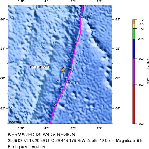
Earthquake Magnitude 6.5 KERMADEC ISLANDS
REGION
Friday, March 31, 2006 at 13:20:59 UTC
|
|
|
|

|
|
|
|
Earthquake record of surface waves as recorded by UPPA. |
|
|
|
|
|
|
|
|
Magnitude |
6.5 (Strong) |
|
Date-Time |
Friday, March 31,
2006 at 13:20:59 (UTC)
= Coordinated Universal Time
Saturday, April
1, 2006 at 1:20:59 AM
= local time at epicenter
Time of Earthquake in other Time Zones
|
|
Location |
29.437°S, 176.754°W |
|
Depth |
10 km (6.2 miles) set by location
program |
|
Region |
KERMADEC ISLANDS REGION |
|
Distances |
110
km (70 miles) E of Raoul Island, Kermadec
Islands
300 km (190 miles) NE of L'Esperance
Rock, Kermadec Islands
1140 km (710 miles) NE of Auckland, New
Zealand
1515 km (940 miles) NNE of WELLINGTON,
New Zealand
|
|
Location Uncertainty |
horizontal +/- 7.8 km (4.8 miles); depth
fixed by location program |
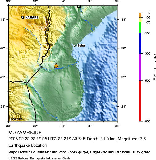
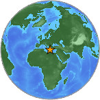
Earthquake Magnitude 7.5 MOZAMBIQUE recorded by UPPA
Wednesday, February 22, 2006 at 22:19:08 UTC
UPPA Record of 7.5 - Mozambique (click on thumbnail below
for full resolution image).
|
|
|
|

|
|
|
|
Two records of the earthquake showing body and surface waves well recorded by UPPA. |
|
|
|
|
|
|
|
|
Magnitude |
7.5 |
|
Date-Time |
Wednesday, February 22,
2006 at 22:19:08 (UTC)
= Coordinated Universal Time
Thursday, February 23, 2006
at 12:19:08 AM
= local time at epicenter
Time of Earthquake in other Time Zones
|
|
Location |
21.211°S, 33.510°E |
|
Depth |
11 km (6.8 miles) set by location program |
|
Region |
MOZAMBIQUE |
|
Distances |
210 km (130 miles) SW of Beira, Mozambique
230 km (145 miles) S of Chimoio, Mozambique
535 km (330 miles) N of MAPUTO, Mozambique
990 km (620 miles) NNE of Durban, South Africa
|
|
Location Uncertainty |
horizontal +/- 10.9 km (6.8 miles); depth fixed by
location program |
Earthquake from Banda Sea recorded by UPPA.
UPPA Record of 7.6 - Banda Sea (click on thumbnail below
for full resolution image).
|
|
|
|

|
|
|
|
Arrival of body waves from Banda Sea earthquake |
|
|
|
|
|
|
|
|
 and surface waves recorded to UPPA.")
|
|
|
|
Longer record showing both body waves (left portion) and surface waves recorded to UPPA. |
|
|
|
|
|
|
|
|
Magnitude 7.6 - BANDA SEA
2006 January 27 16:58:49 UTC
Preliminary Earthquake Report
U.S. Geological Survey, National Earthquake Information Center
World Data Center
for Seismology, Denver
|
A major earthquake occurred at
16:58:49 (UTC) on Friday, January 27, 2006. The magnitude 7.6
event has been located in the BANDA SEA. The hypocentral depth was
estimated to be 346 km (215 miles). (This event has been reviewed
by a seismologist.)
|
| |
|

|
| |
|
|
Magnitude |
7.6 |
|
Date-Time |
Friday, January 27, 2006 at 16:58:49 (UTC)
= Coordinated Universal Time
Saturday, January 28, 2006 at 1:58:49 AM
= local time at epicenter
Time of Earthquake in other Time Zones |
|
Location |
5.451°S, 128.075°E |
|
Depth |
346.2 km (215.1
miles) |
|
Region |
BANDA SEA |
|
Distances |
195 km (120 miles) S of Ambon, Moluccas, Indonesia
440 km (275 miles) NE of DILI, East Timor
825 km (520 miles) NNW of DARWIN, Northern Territory,
Australia
2355 km (1470 miles) E of JAKARTA, Java, Indonesia
|
|
Location Uncertainty |
horizontal +/- 7.1
km (4.4 miles); depth +/- 12.6 km (7.8 miles) |
|
Parameters |
Nst=152, Nph=152,
Dmin=>999 km, Rmss=1.18 sec, Gp= 29°,
M-type=teleseismic moment magnitude (Mw), Version=9 |
|
Source |
USGS NEIC (WDCS-D)
|
|
Event ID |
usika7 |
| Felt Reports |
Felt (V) on Ambon; (IV) at Kupang, Saumlaki, Sorong, Tual, and
Waingapu; (III) at Makassar, Indonesia. Felt at Denpasar. Felt
(IV) at Dili, East Timor and (III) at Darwin, Australia. Also
felt at Jabiru and Humpty Doo-MacMinns Lagoon, Australia.
|
|
|
|
Earthquake from Southern Greece recorded by UPPA.
UPPA Record of 6.7 - Southern Greece (click on thumbnail below
for full resolution image).
|
|

|
|
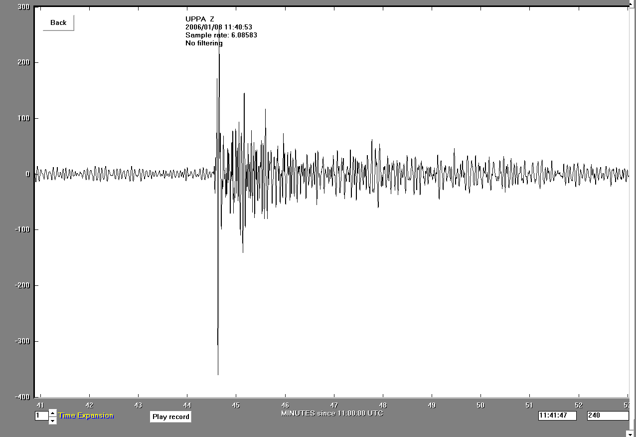
Recording from UPPA
Note the body waves on the left portion followed by surface wave arrivals. |
|
|
Magnitude 6.7 - SOUTHERN GREECE
2006 January 8 11:34:52 UTC
Preliminary Earthquake Report
U.S. Geological Survey, National Earthquake Information Center
World Data Center
for Seismology, Denver
|
A strong earthquake occurred at
11:34:52 (UTC) on Sunday, January 8, 2006. The magnitude 6.7 event
has been located in SOUTHERN GREECE. The hypocentral depth was
estimated to be 38 km (23 miles). (This event has been reviewed by
a seismologist.)
|
| |
|

|
| |
|
|
Magnitude |
6.7 |
|
Date-Time |
Sunday, January 8, 2006 at 11:34:52 (UTC)
= Coordinated Universal Time
Sunday, January 8, 2006 at 1:34:52 PM
= local time at epicenter
Time of Earthquake in other Time Zones |
|
Location |
36.250°N, 23.498°E |
|
Depth |
37.7 km (23.4
miles) |
|
Region |
SOUTHERN GREECE |
|
Distances |
95 km (60 miles) NNW of Chania, Crete, Greece
150 km (95 miles) SE of Kalamata, Greece
185 km (115 miles) NW of Iraklion, Crete, Greece
195 km (120 miles) S of ATHENS, Greece
|
|
Location Uncertainty |
horizontal +/- 6.5
km (4.0 miles); depth +/- 10.5 km (6.5 miles) |
|
Parameters |
Nst=192, Nph=192,
Dmin=677.2 km, Rmss=0.94 sec, Gp= 54°,
M-type=moment magnitude (Mw), Version=6 |
|
Source |
USGS NEIC (WDCS-D)
|
|
|
|
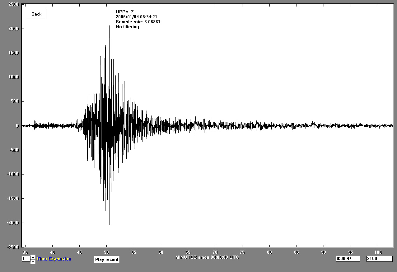
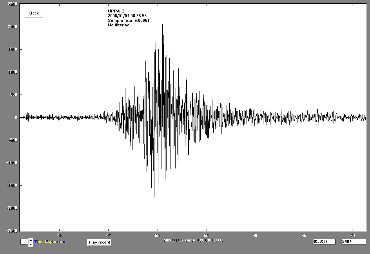
Earthquake from Gulf of California recorded by UPPA.
UPPA Record of 6.6 - Gulf of California Earthquake (click on thumbnail below
for full resolution image).
|
|

|
|
UPPA Record. Note large earthquake event
|
|
|
|
Unfiltered record showing body and surface waves
|
|
|
|
Body and Surface waves recorded to UPPA
|
|
|
Magnitude 6.6 - GULF OF CALIFORNIA
2006 January 4 08:32:30 UTC
Preliminary Earthquake Report
U.S. Geological Survey, National Earthquake Information Center
World Data Center
for Seismology, Denver
|
A strong earthquake occurred at
08:32:30 (UTC) on Wednesday, January 4, 2006. The magnitude 6.6
event has been located in the GULF OF CALIFORNIA. (This event has
been reviewed by a seismologist.)
|
| |
|

|
| |
|
|
Magnitude |
6.6 |
|
Date-Time |
Wednesday, January 4, 2006 at 08:32:30 (UTC)
= Coordinated Universal Time
Wednesday, January 4, 2006 at 1:32:30 AM
= local time at epicenter
Time of Earthquake in other Time Zones |
|
Location |
28.067°N,
112.105°W |
|
Depth |
10 km (6.2 miles)
set by location program |
|
Region |
GULF OF
CALIFORNIA |
|
Distances |
85 km (53 miles)
NNE (12°) from Santa Rosalía, Baja California Sur, Mexico
85 km (53 miles) NNE (15°) from Santa Rosalia, Baja Calif.
Sur, Mexico
106 km (66 miles) SW (215°) from La Doce, Sonora, Mexico
157 km (98 miles) SW (225°) from Hermosillo, Sonora, Mexico
685 km (425 miles) SE (135°) from Tijuana, Baja California,
Mexico
|
|
Location Uncertainty |
horizontal +/- 3.4
km (2.1 miles); depth fixed by location program |
|
Parameters |
Nst=196, Nph=196,
Dmin=764 km, Rmss=0.88 sec, Gp= 54°,
M-type=moment magnitude (Mw), Version=7 |
|
Source |
USGS NEIC (WDCS-D)
|
|
Event ID |
ushmal |
| Felt Reports |
Felt (IV) at Hermosillo. Also felt at Bahia de Kino, Guaymas and
Guerrero Negro. |
|
|
|
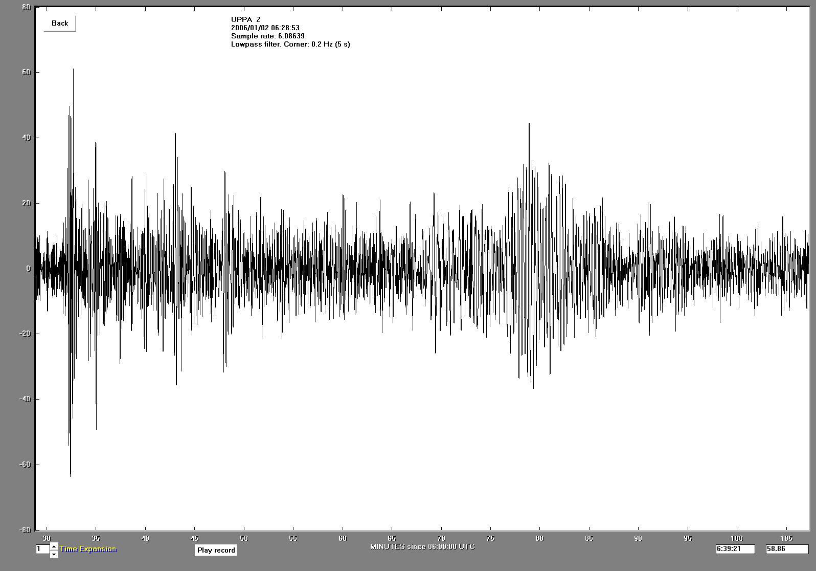
Earthquake from Western Pacific (South Sandwich Islands) recorded by UPPA.
UPPA Record of 7.3 - South Sandwich Islands Region Earthquake (click on thumbnail below
for full resolution image).
|
|
|
|
AS-1 UPPA Earthquake Record
Note the body waves (left hand portion) and surface wave (just right of the center of this image) on this record. |
|
|
Magnitude 7.3 - EAST OF THE SOUTH SANDWICH
ISLANDS
2006 January 2 06:10:49 UTC
Preliminary Earthquake Report
U.S. Geological Survey, National Earthquake Information Center
World Data Center
for Seismology, Denver
|
A major earthquake occurred at
06:10:49 (UTC) on Monday, January 2, 2006. The magnitude 7.3 event
has been located EAST OF THE SOUTH SANDWICH ISLANDS. (This event
has been reviewed by a seismologist.)
|
| |
|

|
| |
|
|
Magnitude |
7.3 |
|
Date-Time |
Monday, January 2, 2006 at 06:10:49 (UTC)
= Coordinated Universal Time
Monday, January 2, 2006 at 5:10:49 AM
= local time at epicenter
Time of Earthquake in other Time Zones |
|
Location |
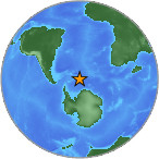
60.809°S, 21.451°W |
|
Depth |
10 km (6.2 miles)
set by location program |
|
Region |
EAST OF THE
SOUTH SANDWICH ISLANDS |
|
Distances |
345 km (215 miles) SE of Bristol Island, South Sandwich
Islands
565 km (350 miles) SE of Visokoi Island, South Sandwich
Islands
1155 km (720 miles) SE of Grytviken, South Georgia
3270 km (2030 miles) N of South Pole, Antarctica
|
|
Location Uncertainty |
horizontal +/-
10.8 km (6.7 miles); depth fixed by location program |
|
Parameters |
Nst= 94, Nph= 94,
Dmin=>999 km, Rmss=1.21 sec, Gp= 47°,
M-type=teleseismic moment magnitude (Mw), Version=6 |
|
Source |
USGS NEIC (WDCS-D)
|
|
Event ID |
ushkac |
|
|
|
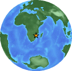
Earthquake from African rift region recorded by UPPA.
UPPA Record of 6.6 - Fiji Region Earthquake (click on thumbnail below
for full resolution image).
|
|
|
|

|
|
|
|
Record of Fiji earthquake from UPPA |
|
|
|
|
|
|
|
|

|
|
|
|
Record of Fiji earthquake from UPPA |
|
|
|
|
|
|
|
|
Magnitude 6.6 - FIJI REGION
2005 December 13 03:16:09 UTC
Preliminary Earthquake Report
U.S. Geological Survey, National Earthquake Information Center
World Data Center
for Seismology, Denver
|
A strong earthquake occurred at
03:16:09 (UTC) on Tuesday, December 13, 2005. The magnitude 6.6
event has been located in the FIJI REGION. The hypocentral depth
was estimated to be 29 km (18 miles). (This event has been
reviewed by a seismologist.)
|
| |
|

|
| |
|
|
Magnitude |
6.6 |
|
Date-Time |
Tuesday, December 13, 2005 at 03:16:09 (UTC)
= Coordinated Universal Time
Tuesday, December 13, 2005 at 3:16:09 PM
= local time at epicenter
Time of Earthquake in other Time Zones |
|
Location |
15.270°S,
178.569°W |
|
Depth |
29.3 km (18.2
miles) |
|
Region |
FIJI REGION |
|
Distances |
115 km (70 miles) SSW of Sigave, Ile Futuna, Wallis and
Futuna
255 km (155 miles) ENE of Lambasa, Vanua Levu, Fiji
340 km (215 miles) SW of MATA'UTU, Ile Uvea, Wallis and
Futuna
2475 km (1540 miles) NNE of Auckland, New Zealand
|
|
Location Uncertainty |
horizontal +/- 7
km (4.3 miles); depth +/- 23.6 km (14.7 miles) |
|
Parameters |
Nst=131, Nph=131,
Dmin=746.1 km, Rmss=0.85 sec, Gp= 76°,
M-type=teleseismic moment magnitude (Mw), Version=7 |
|
Source |
USGS NEIC (WDCS-D)
|
|
|
|
UPPA Record of Magnitude 6.8 - Lake Tanganyika Region Earthquake (click on
thumbnail below for full resolution image).
|
|
|
|

|
|
|
|
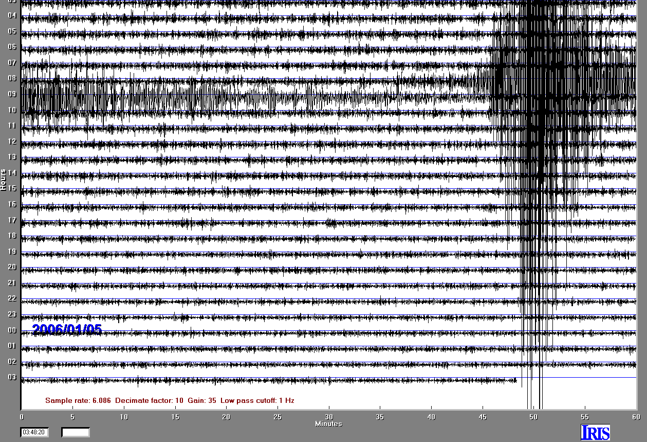
Day seismic record |
|
Note Magnitude 6.8 Lake Tanganyika Region event. |
|
|
|
|
|
|

|
|
|
|
Magnitude 6.8 Event |
|
Extract of Magnitude 6.8 Lake Tanganyika region earthquake. |
|
|
|
|
|
|

|
|
|
|
Magnitude 6.8 event filtered |
|
Fourier filter of Magnitude 6.8 Lake Tanganyika earthquake. |
|
|
|
|
|
|
|

|
|
|
|
Magnitude 6.8 Event Extraction |
|
Fourier filter of Magnitude 6.8 Lake Tanganyika earthquake. |
|
|
|
|
|
|
|
Details from United States Geological Survey regarding this seismic event.
Magnitude 6.8 - LAKE TANGANYIKA REGION,
CONGO-TANZANIA
2005 December 5 12:19:55 UTC
Preliminary Earthquake Report
U.S. Geological Survey, National Earthquake Information Center
World Data Center
for Seismology, Denver
|
A strong earthquake occurred at
12:19:55 (UTC) on Monday, December 5, 2005. The magnitude 6.8
event has been located in the LAKE TANGANYIKA REGION,
CONGO-TANZANIA. (This event has been reviewed by a seismologist.)
|


|
|
Magnitude |
6.8 |
|
Date-Time |
Monday, December 5, 2005 at 12:19:55 (UTC)
= Coordinated Universal Time
Monday, December 5, 2005 at 2:19:55 PM
= local time at epicenter
Time of Earthquake in other Time Zones |
|
Location |
6.212°S, 29.599°E |
|
Depth |
10 km (6.2 miles)
set by location program |
|
Region |
LAKE TANGANYIKA
REGION, CONGO-TANZANIA |
|
Distances |
55 km (35 miles) SE of Kalemie, Dem. Republic of the Congo
150 km (90 miles) S of Kigoma, Tanzania
975 km (600 miles) SW of NAIROBI, Kenya
1590 km (990 miles) E of KINSHASA, Dem. Republic of the Congo
|
|
Location Uncertainty |
horizontal +/-
12.8 km (8.0 miles); depth fixed by location program |
|
Parameters |
Nst=107, Nph=107,
Dmin=>999 km, Rmss=1.08 sec, Gp= 40°,
M-type=moment magnitude (Mw), Version=7 |
|
Source |
USGS NEIC (WDCS-D)
|
|
|
|


")


 followed by surface wave arrivals.")


 and surface waves recorded to UPPA.")